Salto El Atalaya
Aguada
River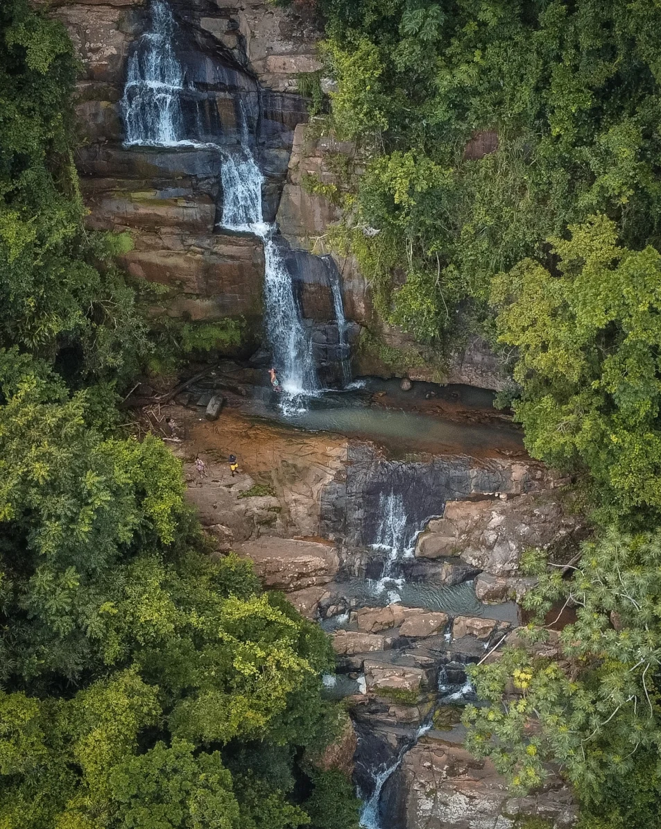
Also known as "Salto la Loca," this waterfall surrounded by vegetation sits in the barrio Atalaya. It is the tallest in a series of falls found in the area.
How to get to the spot
From PR-2 in Aguada, take the exit that connects to PR-419 until you reach Panadería La Viña. At that intersection, keep right onto PR-411, and after about 4-5 minutes you will need to turn onto a local road on the right side (the entrance before what appears on Google Maps as "Pizeria Guarionex").
There are two ways to access the falls area: arriving directly at the upper section or at the lower section. Both paths are moderate and take between 5-7 minutes to reach.
To reach the top of Salto Atalaya (the route I took), follow the Google Maps pin labeled "Salto La Loca." I don't recommend driving down the last dead-end local street that appears as you head toward that pin; the road is a bit narrow and uncomfortable. Leave your vehicle outside and continue on foot from there.
Once you're walking in, take the first entrance on the right and follow the road downhill. You'll then notice the paved road ends and a dirt path begins — you're on the right track. If you follow these marked paths, you'll eventually reach the river ahead. From that point, explore the trails that continue downstream and you'll find small waterfalls and natural pools, until you reach the tallest fall.
Also known as "Salto la Loca," this waterfall surrounded by vegetation sits in the barrio Atalaya. It is the tallest in a series of falls found in the area.
How to get to the spot
From PR-2 in Aguada, take the exit that connects to PR-419 until you reach Panadería La Viña. At that intersection, keep right onto PR-411, and after about 4-5 minutes you will need to turn onto a local road on the right side (the entrance before what appears on Google Maps as "Pizeria Guarionex").
There are two ways to access the falls area: arriving directly at the upper section or at the lower section. Both paths are moderate and take between 5-7 minutes to reach.
To reach the top of Salto Atalaya (the route I took), follow the Google Maps pin labeled "Salto La Loca." I don't recommend driving down the last dead-end local street that appears as you head toward that pin; the road is a bit narrow and uncomfortable. Leave your vehicle outside and continue on foot from there.
Once you're walking in, take the first entrance on the right and follow the road downhill. You'll then notice the paved road ends and a dirt path begins — you're on the right track. If you follow these marked paths, you'll eventually reach the river ahead. From that point, explore the trails that continue downstream and you'll find small waterfalls and natural pools, until you reach the tallest fall.