Did you know that at least two tsunamis have struck Puerto Rico? Here is how you should respond depending on the alert level, and what warning signs to watch for.
For many people, the tsunami advisory on Feb. 8 caused alarm and confusion. Some left the water immediately, others began looking for information on how to respond, and in some municipalities, such as Aguadilla, alarms even sounded to evacuate coastal areas. But what should the response have been?
We offer this guide to responding to a tsunami, based on the Guía de Preparación ante Tsunamis para la Comunidad Marítima from the TsunamiReady program and the Red Sísmica de Puerto Rico (RSPR).
What is a tsunami?
This word of Japanese origin means "wave in harbor." A tsunami is "an anomalous rise in sea level, sometimes seen as a series of waves with a long wavelength and period (time between crest and crest), generated by a large impulsive displacement of seawater," the guide explains. The time between waves can range from minutes to hours.
Even a small-amplitude tsunami could cause whirlpools and strong currents, which could be associated with damage to vessel moorings, mooring lines, docks, ports and marinas. But port and marina facilities are not the only things highly vulnerable to tsunamis. Good plans and preparation are essential to avoid loss of life and property.
What causes tsunamis?
Tsunamis are commonly caused by regional and distant earthquakes or underwater landslides. They can also be caused by a volcanic eruption or a meteorite impact, though those are less likely.
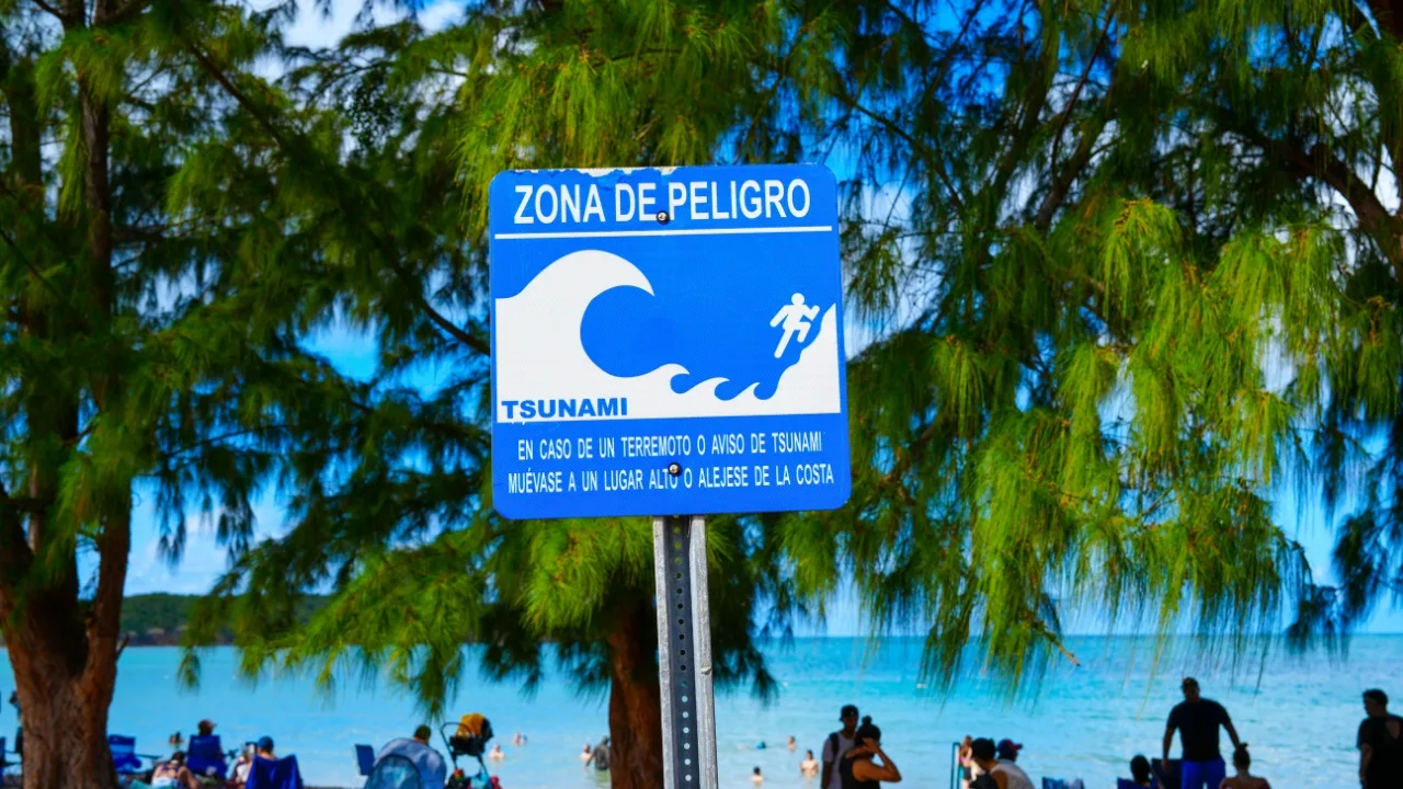
Types of TsunamiReady signs installed in municipalities that participate in the program. (Source: Red Sísmica de Puerto Rico)
How likely is a tsunami in Puerto Rico?
The tsunami hazard for Puerto Rico is real, the Red Sísmica warns. At least two tsunamis have struck our coastal region, in 1867 and 1918, causing damage and deaths.
A third tsunami event was recorded in 2020, but it was minor and imperceptible to people. That minor tsunami measured approximately 2.36 inches.
The Red Sísmica estimates, based on 2020 Census data, that roughly 213,583 people in Puerto Rico live in tsunami-exposed zones, which is why education about these phenomena through programs such as TsunamiReady is necessary.
What are the different tsunami alert levels?
Alert levels establish the danger posed by a possible tsunami event and are tied to a set of recommended actions. They generally include seismic information, the estimated arrival time of the first wave and the estimated height. These alert levels are:
1. Tsunami warning (aviso de tsunami)
This is the highest emergency alert level and is issued when there is an imminent danger of tsunami coastal flooding.
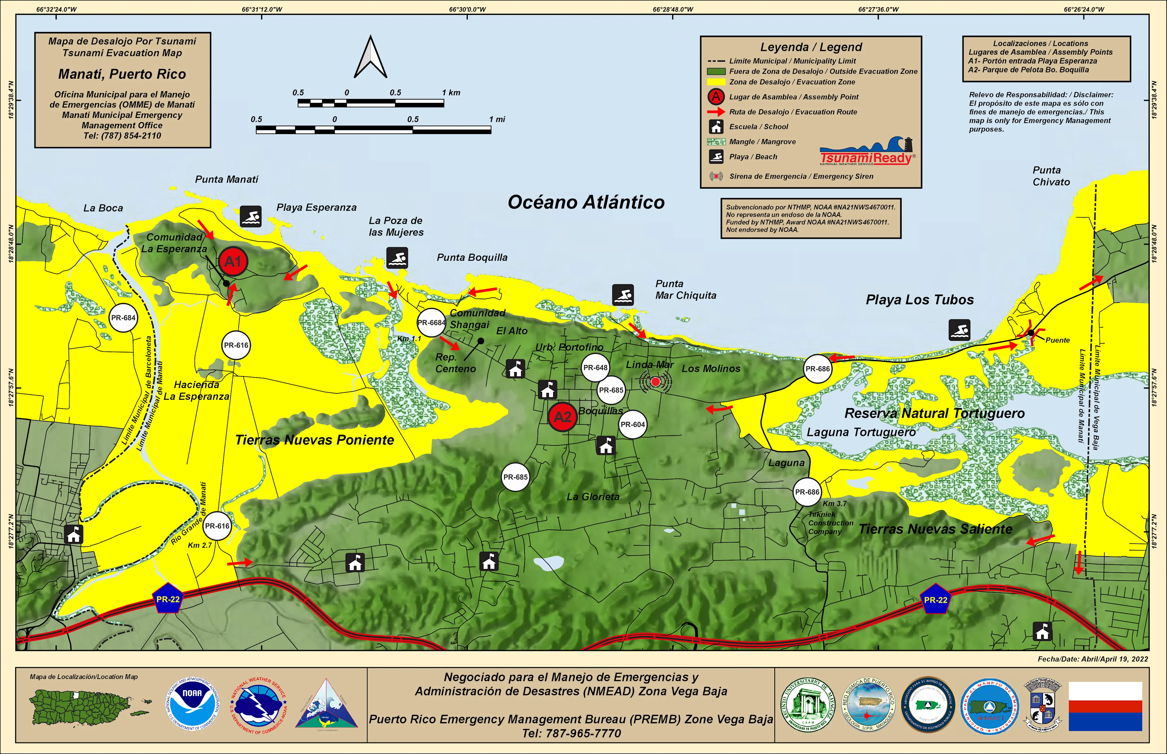
Recommended actions: This level requires immediate evacuation of the zones identified in yellow on the evacuation maps, as well as moving to higher ground and following instructions from emergency agencies.
2. Tsunami advisory (advertencia de tsunami)
Issued when there is a danger of strong currents and hazardous surf. The advisory may be upgraded to a tsunami warning or canceled.
Recommended actions: Leave the water, beach, marinas, ports and inlets. Evacuation of yellow zones is not required.
3. Tsunami watch (vigilancia de tsunami)
Issued when an event could affect the coastal zone at a later time, but how it will do so is still unknown. It may be upgraded to an advisory or a warning, or canceled.
Recommended actions: Monitor official information.
4. Tsunami information bulletin (tsunami information statement)
An informational message about a seismic event that has just occurred with no potential to generate a tsunami.
Recommended actions: Stay calm. A tsunami watch, warning or advisory has not yet been issued.
5. Cancellation
Issued when it is determined that there is no longer a tsunami threat. Note, however, that fluctuations in sea level may continue.
6. "All clear"
The message issued by emergency response agencies when it has been established that people may return to affected areas because the tsunami threat has passed. This message could take hours or days, depending on the impact.
These alerts are issued via radio, television, cellphones and outdoor sirens.
Map of estimated tsunami arrival times in the Atlantic basin. Data obtained from the Tide Tool (PTWC). (Source: Red Sísmica de Puerto Rico)
When are tsunami sirens activated?
Fixed sirens are a key tool in the early tsunami warning system, operated by municipalities to protect people in open areas, as established by the Guía para Operadores de Puntos Focales de Alerta de Tsunami. These high-powered devices are activated remotely from a focal point using a console, portable radio or computerized system.
The Protocolo de Activación de Sirena(s) Fija(s) para Alerta por Tsunami establishes that these sirens must be activated when a tsunami advisory is issued for Puerto Rico and the Virgin Islands. The tone for a tsunami advisory will be the "Wail Whoop" tone, followed by a spoken message indicating the actions to take (evacuation, moving away from the coast as quickly as possible, seeking higher ground).
In the event of a tsunami warning, siren activation is left to the discretion of municipalities, particularly those in hard-to-reach areas. The sound used must be different from the one used during an advisory, followed by a spoken message indicating the actions to take (leave the water, beaches, ports and marinas).
According to the document, following the damage caused by hurricanes Irma and María in 2017, work has been carried out to repair and install new sirens, whose inventory and status are monitored by the Negociado para el Manejo de Emergencias y Administración de Desastres (NMEAD).
How much time is there to respond to a possible tsunami?
This is known as arrival time, or estimated time of arrival (ETA), and refers to the actual time it could take for the first wave of the tsunami to reach the region. Three possible scenarios are distinguished: local, regional and distant.
In the local scenario, the worst of the three, there is one hour or less (minutes) to respond, as that is how long it would take the wave to reach the region. This means the tsunami source is 100 km or less from the coast.
In the regional scenario, there is one to three hours to respond. The tsunami source is between 100 km and 1,000 km from the coast.
In the distant scenario, there is more than three hours to respond. The tsunami source is more than 1,000 km from the coast.
The PTWC model uses only two scenarios: near (three hours or less) and distant (more than three hours).
🫨 A strong earthquake: it is hard to stay on your feet, objects fall, and there is damage to infrastructure.
🚨 A long earthquake: 20 seconds or more.
🌊 A sudden change in sea level: if you are on the coast, you will see the ocean recede suddenly or the tide rise in an unusual way.
⚠️ Unusual ocean behavior: a loud noise is heard (like a train or a plane). A long wave is visible on the horizon, or a wall of water is approaching.
If you see any of these signs and you are near the coast, find higher ground immediately, either by moving inland away from the coast or going up to the highest floor of a building (fourth floor or above).
‼️ In moments of emergency or uncertainty, remember to stay informed using reliable, fact-based sources. Here are several additional educational resources for you and your family:
This content was translated with the assistance of Artificial Intelligence (AI).